Menorca
The idea of life on a Mediterranean island is a romantic notion, but we knew little about what to expect from Menorca, just a 45-minute flight from Barcelona and about 2½ times the size of Martha’s Vineyard. See our blog post “Island Time” for more! 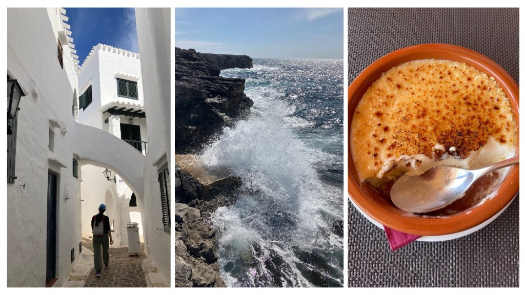
The village of Binibeca (l), powerful waves on a rocky coast (m), and Menorcan cheese ice cream (r)—in this case with a crispy caramel top like creme brulé. 
The Cami de Cavalls trail dates to 1330 AD and circumnavigates the island in 20 sections. We hiked all or part of 9, each one a little different. 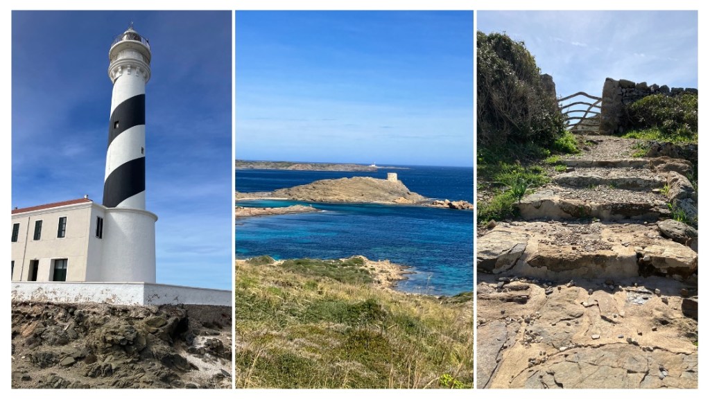
This section of the trail winds through a series of wood-frame gates to a cliff walk, where we could see defensive towers built in the 1700s and a wind-swept lighthouse at the end. 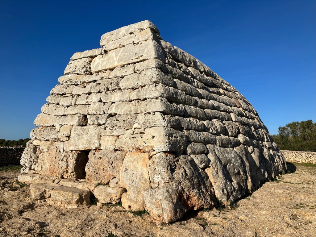
Menorca also has one of the highest concentrations of prehistoric sites in the world. This tomb, with massive stones at the base and three layers of wall without the use of mortar, dates to 1,600 BCE. 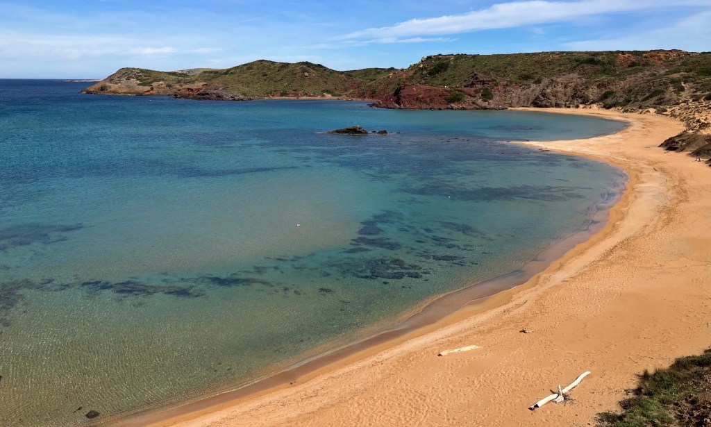
Many of Menorca’s most beautiful beaches can only be accessed by hiking to them. In the off-season, they are often completely free of people—though the crystal-clear water is still a bit chilly for swimming. 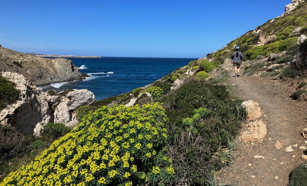
Signs of spring were everywhere, brightening the otherwise rocky, arid landscape by the shore. 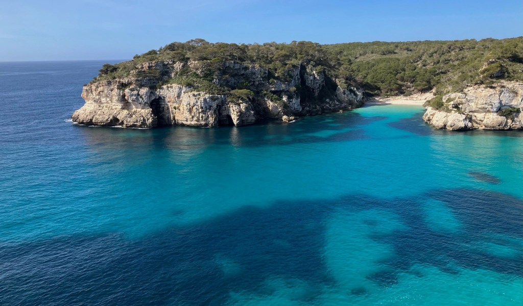
The stunning aquamarine waters of the coves and beaches on Menorca never ceased to inspire us to take deep breaths, slow our pace, and gaze. This one, called Cala Turqueta, is one of the island’s most beloved. 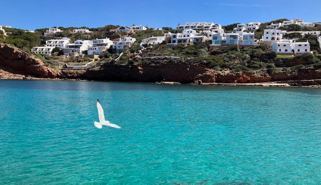
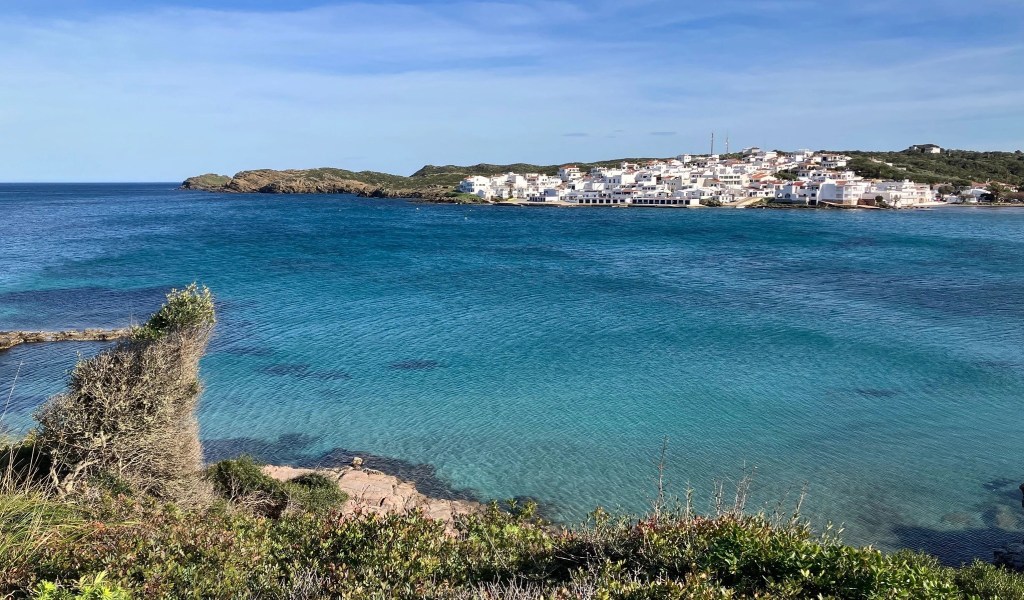
The trail also runs through many of the island’s coastal villages, some old, some new, but all bright white to reflect the summer heat. Even the birds have gotten the memo about wearing white!
Málaga

Málaga is a big, bustling city on the southern coast, with an airport, cruise ship port, major highways, and large pedestrian shopping area. It’s also an historic city that only recently began to uncover and preserve its treasures. It has the Mediterranean on one side and jagged peaks on the other. When we were there, some of the peaks were capped with snow. 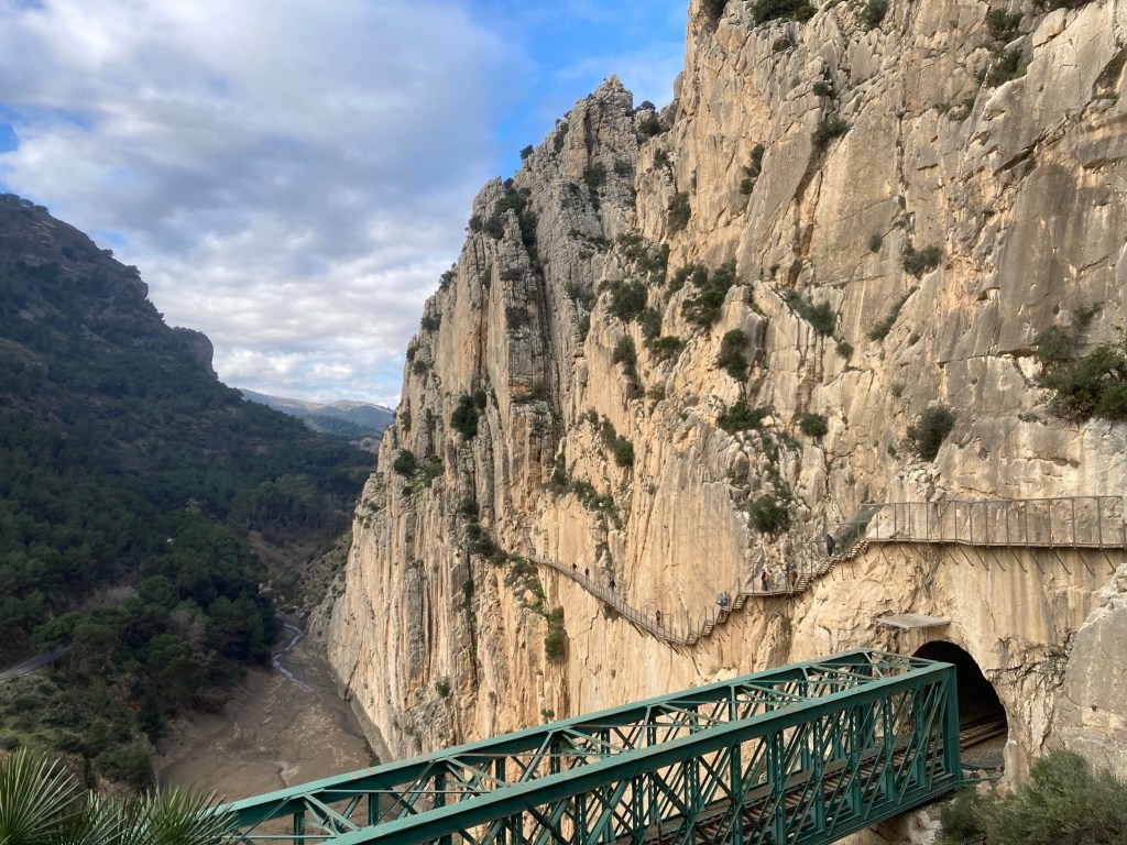
An hour’s drive north is El Caminito del Rey – the little walk of the king. First built in the early 1900s, it became a thrill-seeker’s adventure until a new walkway was built so it could become a safe tourist attraction. The walkway clings to the side of this cliff above a rail tunnel. 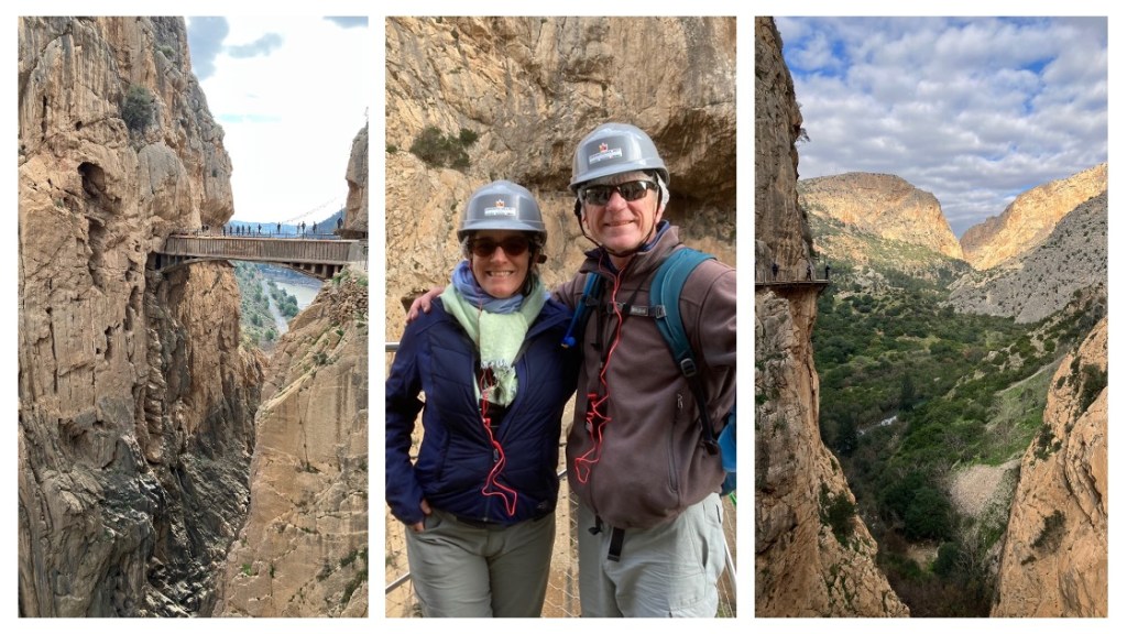
The Caminito includes crossing a bridge over a deep chasm. I don’t think the plastic helmets they make everyone wear would help in a fall! Despite the crowds and vertigo–inducing heights, the payoff views across the gorge are magnificent. Note the walkway in the right photo, clinging to the left cliff. 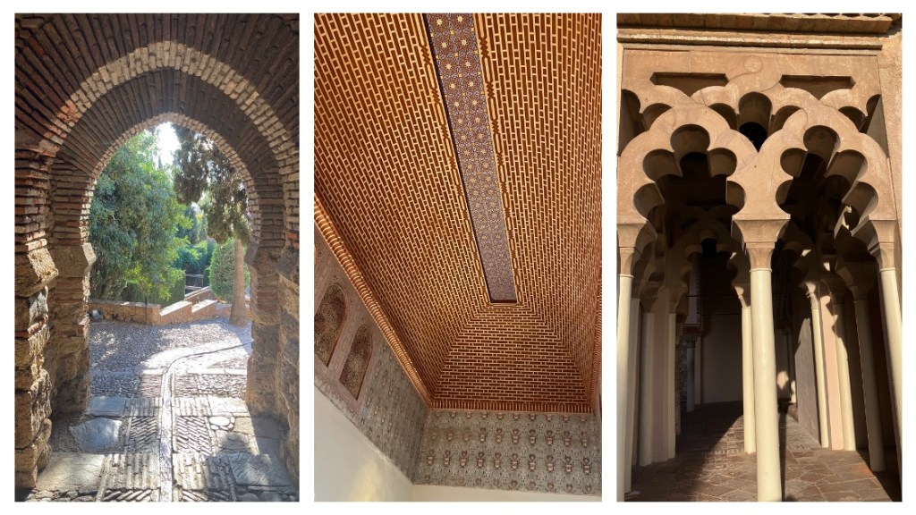
The big historic structure in Málaga is the Alcazaba, a moorish castle built around 1100 AD. Forty years of restoration has revealed beautiful archways and tiled ceilings like the more famous Alhambra in Granada. 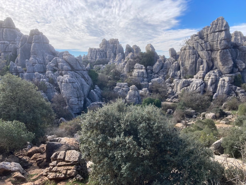
North of Málaga is a nature reserve called El Torcal de Antequera, which has trails winding through Jurassic Age limestone rock formations. When we were there it was cold (30s F) and windy in exposed areas, so there were few tourists and each valley we entered felt hushed and still. It’s so beautiful and unique that we’ll share several pictures of it! 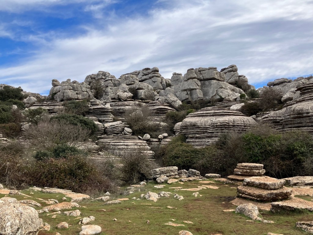
Eons of tectonic plates shifting, oceans receding, freeze/thaw cycles, and erosion from wind and rain have resulted in a stunning array of rock shapes and forms. 
The site is still populated by the Iberian Ibex (left) and it’s easy to find fossilized remnants of the area’s underwater past (hard to imagine when you’re standing at more than 3000 feet). Around every bend it seems there’s another unique view across a valley or into a cave. 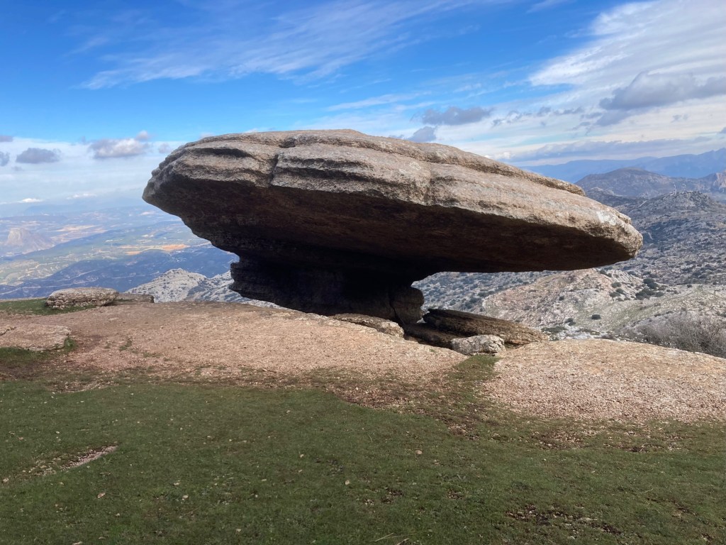
But this view was probably the best of all, an eroded rock standing impossibly on the edge of a windswept peak. We saw it while hiking a mostly unmarked trail using our GPS and, despite clambering like mountain goats looking for the trail after we’d lost it, we did make it back to the car. And this view was worth it! 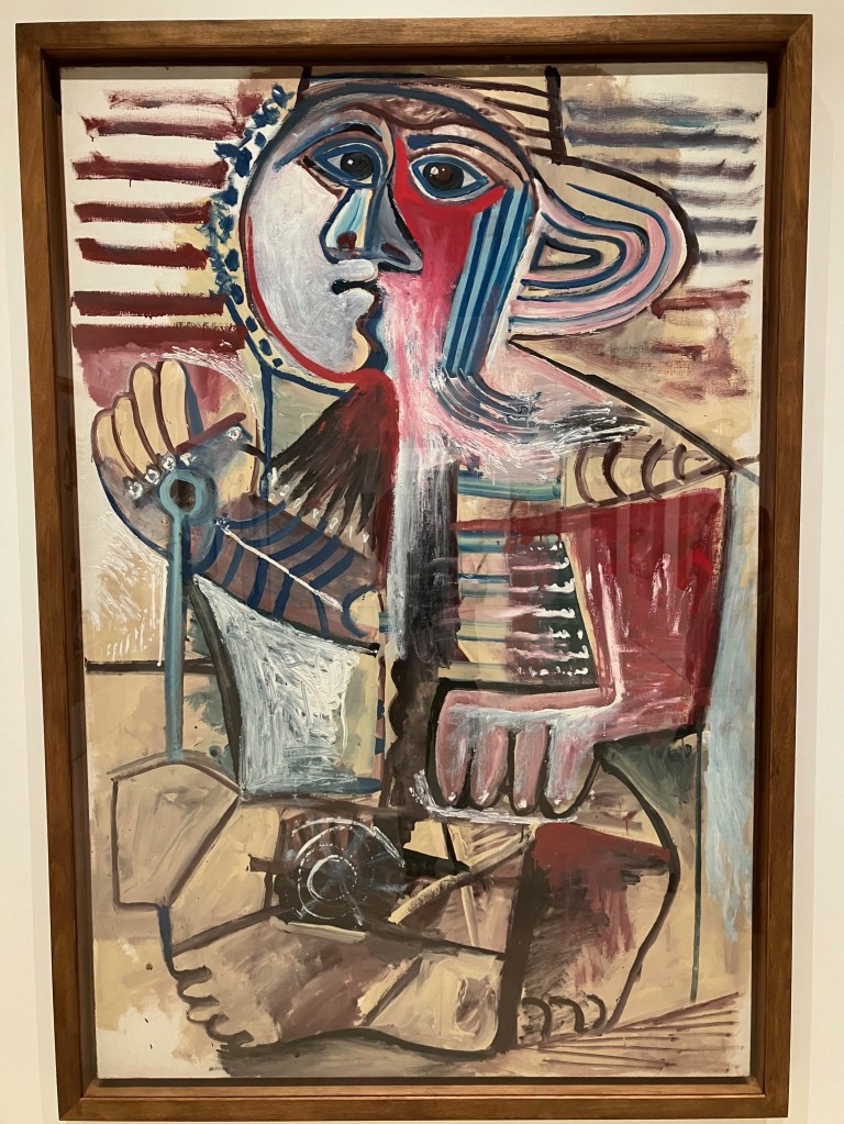
Málaga is also the birthplace of Picasso. While his most famous paintings are elsewhere, their Picasso museum provides historical and social context for his long life as an artist. This painting was accompanied by a quote from his visit to an exhibition of children’s drawings: “When I was their age I could draw like Raphael, but it took me a lifetime to learn to draw like them.”
Pueblos Blancos
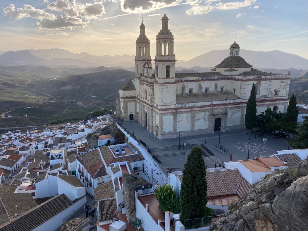
Our first stay in a Pueblo Blanco was in Olvera. After we arrived, we walked up to catch the sunset at the top of the hill, where the castle fort overlooks the hills, the town, and its cathedral. 
Our second stay was in Castellar de la Frontera. (A lot of towns in the south have “de la Frontera” in their name because the frontier of “reconquering” Spain from the Moors kept moving slowly southward until 1492). The little village around the castle on top of the cliff has only 15 full time residents—everyone else lives below. 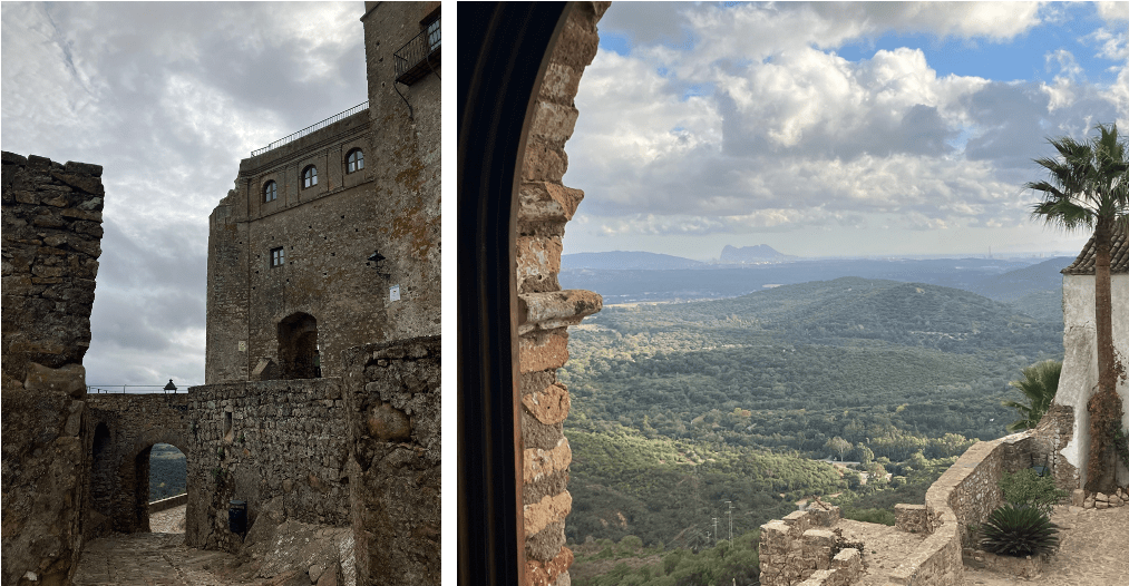
While most of the castles are now tourist attractions, in Castellar it’s actually a hotel too. So for a few nights, we had our own “castle in Spain,” complete with stone ramparts and balconies. The three high windows were our room, and from one of them, we could see Gibraltar in the distance. 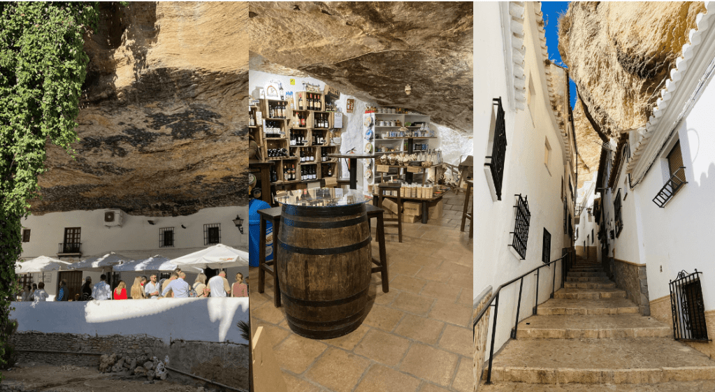
We also visited Setenil, which is known for buildings in or under dramatic rock overhangs and cliffs. Here you can see a cafe, a shop, and a street. The back halves of many of the houses are fully built into caves. 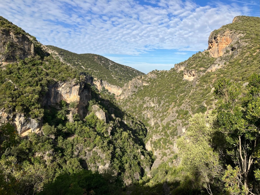
There are also some beautiful hikes. This one is called “Garganta Verde” or Green Gorge – but garganta can also mean “throat”, so we wondered what would await us as we descended into it… 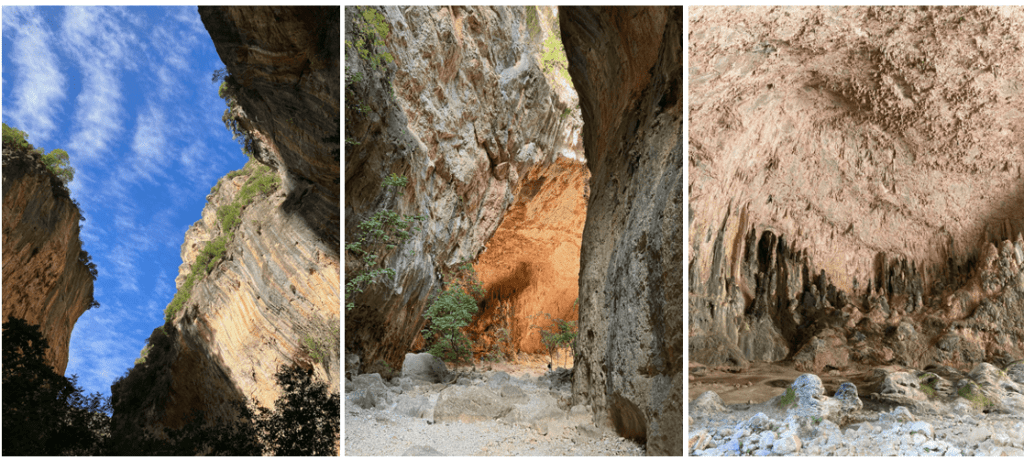
The cliffs began to loom over us; when we reached the bottom of the gorge, we found a dry river bed. Up ahead, the walls began to glow until we reached an open cavern with otherworldly rock formations. From a distance it looked like a gigantic organ in a cathedral—or a very sore throat. 
And when we stood inside this “cathedral” and looked back out, we could see that some of the rocks had formed smooth, swirling bumps like waves, from millennia of dripping from above and (we imagine) water flowing through during the wet season. 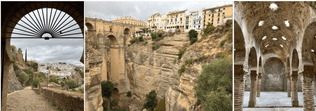
Finally we stopped in Ronda, far to the south, known for its cliff-top location, Moorish architecture, and well-preserved Moorish baths (built upon Roman baths). 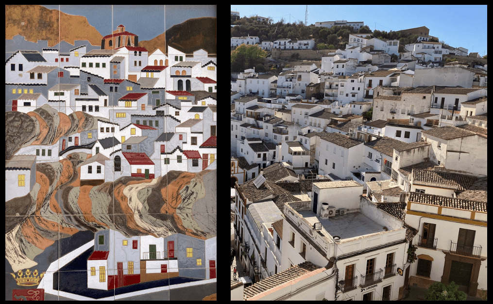
Compare this mosaic of Setinil with the photo. This is the art and design of the Pueblo Blanco.
Asturias and the Picos

Gijon, the capital of Asturias, curves around a beach, with its Romanesque church at the foot of an historic peninsula. On the other side of the peninsula lies an industrial seaport. 
A reconstructed pre-Roman hut sits on a bluff where the first settlement of Gijon was built in the 6th century BC. Stone walls and moats once protected the encampment from invaders, but now are encroached by industry. 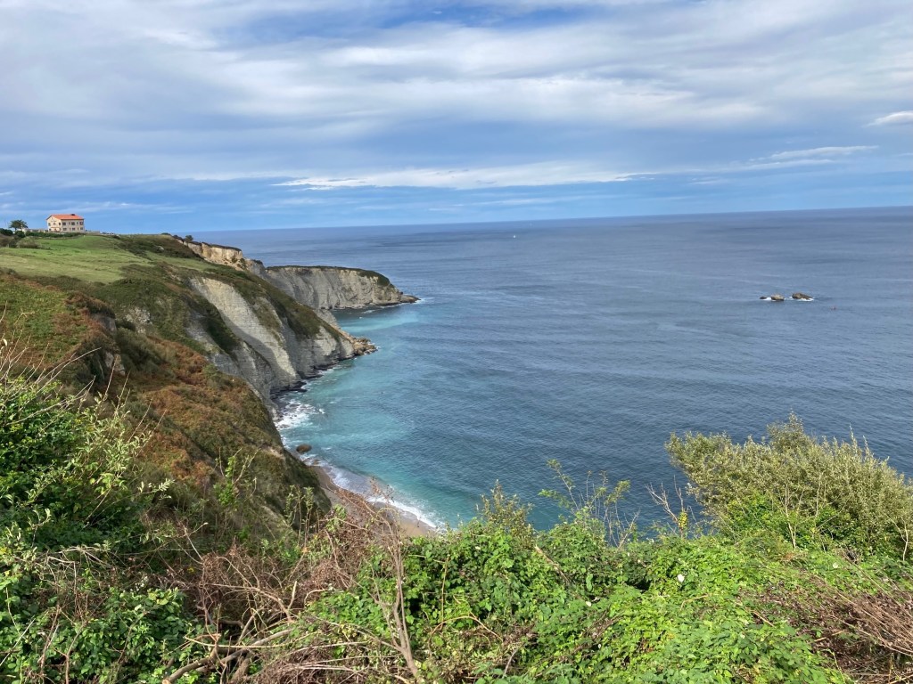
The coastline of Gijon looks like it could have broken off from Ireland (due north), and seafaring Celts did in fact land here en route to points south. 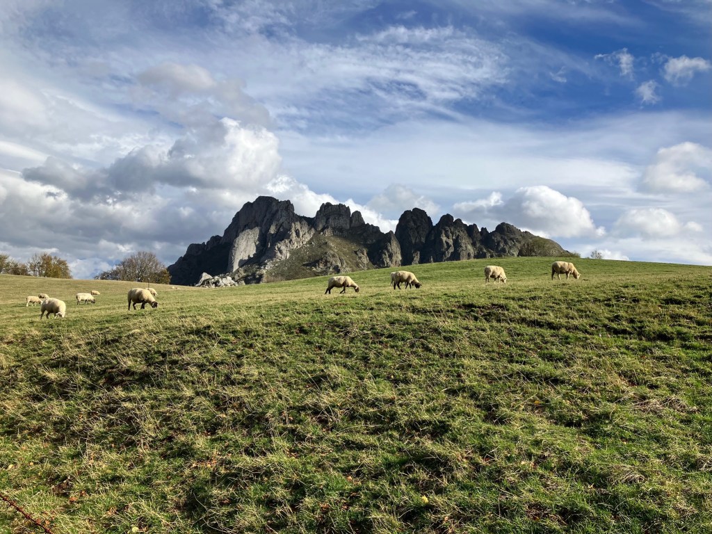
Grassy fields high among the jagged peaks in Asturias and Cantabria offer plenty for local sheep, cows, and horses to feast on. 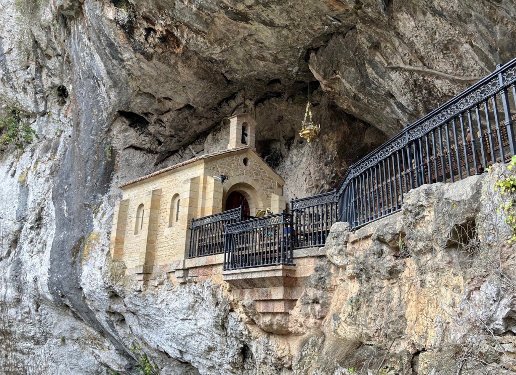
In Covadonga, the “reconquest” of Spain from the Moors began in 722 A.D., and legend says that Pelayo, the leader of the rebellion, prayed in this cave. A chapel was built in his honor. 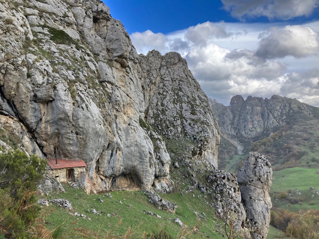
Farmers also built structures into the cliff walls, like this shepherd’s shelter high in the mountains. 
The Picos de Europa National Park features massive ridges of stony peaks like these, some of which are famous destinations for rock climbers. We preferred to look up at them. 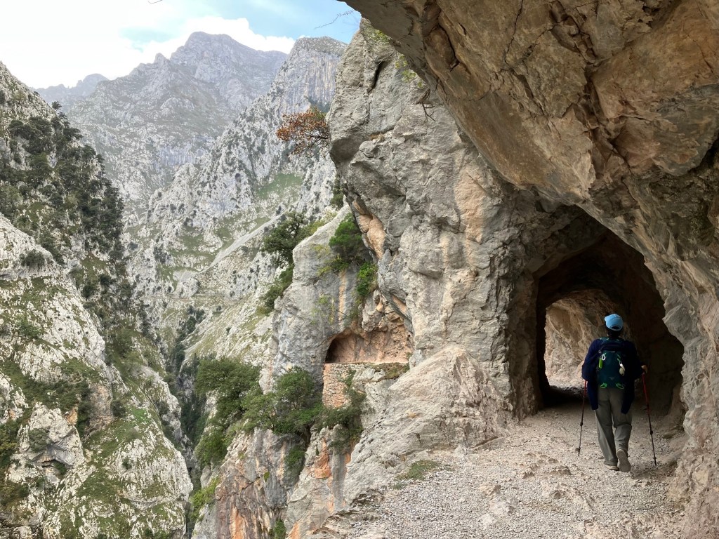
La Ruta del Cares canyon path was carved into and through these steep rocky cliffs for 11 km in order to connect a mining town to the outside world in 1916-21. Now it’s one of the most popular hikes in Spain. 
Los Lagos — the lakes — is the most popular and perhaps the most scenic area of the Picos de Europa park.

These photographs of places I’ve never seen are enchanting. So are your descriptions. Great! Just great!
LikeLiked by 1 person